


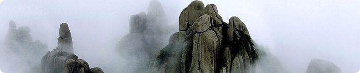
The People’s Republic of China, with a land area of 9.6 million square kilometers and a water area of about 4.73 million square kilometers, is the biggest country in Asia and the third largest country in the world.  The topography descends toward sea level from west to east and gives rise to a variety of landforms. Mt. Everest in the Himalayan mountain range and lying on the southeast edge of China at 8,848 meters above sea level, is the world’s highest peak. The Yangtze and Yellow Rivers, 6,300 kilometers and 5,464 kilometers long respectively, are the most important rivers in China and the Jinghang Canal, which stretches for 1,794 kilometers, is one of the longest artificial canals in the world. Qinghai Lake has an area of 4,583 square kilometers and is the largest inland salt water lake in China while Poyang Lake has an area of 3,583 square kilometers and is China’s largest freshwater lake.
China experiences a  complex and varied climate. Most parts of the country lie in the northern temperature zone and subtropical zone and belong to the eastern Asia monsoon climatic area. In winter, the climate is cold and dry and the temperature difference betweenthe south and the north can be forty degrees centigrade, while in summer temperatures are high, it is the rainy season and temperature differences are small. However precipitation varies from 1,500 mm in the southeast to less than 50 mm in the northwest. The extremely high mountainous regions have constantly cold weather and the Qinghai-Tibet Plateau has a unique plateau climate, with a variety of mineral elements and abundant water resources.
 WeChat
 Weibo
Weibo主办运营单位 / 版权所有:全国妇联社会联络与交流合作中心(中国妇女外文期刊社)
Email: website@womenofchina.cn 投诉举报电话:010-65103955,65103946
 京公网安备 11010102004314号 京ICP备10020604号-1